The start of June is the start of meteorological summer across the Northern Hemisphere. The meteorological seasons are each three months long. Summer is June to August, fall is September to November, winter is December to February, and spring is March to May. Astronomically, summer starts on the summer solstice, which falls on June 21.
Now it’s time to look at the last month and examine how spring turned out across the Canadian Prairies. After that, we will look at long-range forecasts.
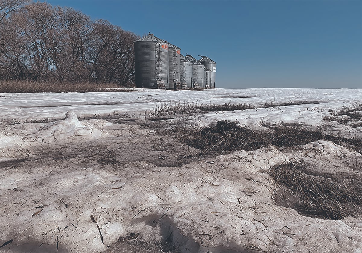
If you were to pick one word summarizing May across the Prairies, that word would be “hot.” I checked when the last frost occurred. In Manitoba, it was during the first few days of the month. In Saskatchewan, it was later for Regina, on May 19, but earlier in Saskatoon, on April 30. In Alberta, Peace River saw its last spring frost on May 8, Edmonton on April 30 and Calgary on April 26. These are truly early dates across the Prairies. It’ll be interesting to see how long this year’s frost-free season will be.
Read Also
Prairie spring forecast: What weather models predict for March to May
Weather models offer varied outlooks for Prairie spring. This forecast review compares Old Farmer’s Almanac, NOAA, CFS, CanSIPS, and ECMWF predictions for March through May temperatures and precipitation.
The last spring frost dates indicate a warm May. All major stations reported mean monthly temperatures well above the long-term average. They ranged from a low of 3.4 C above average at Dauphin, Man., to a high of 5.2 C above average in Calgary.
As for actual temperatures, Winnipeg was the hot spot with a mean monthly temperature of 15.8 C, while Peace River was the cold spot at 13.6 C.
Another measure of May’s warmth is the number of days warmer than 30 C. Once again, Winnipeg was the hotspot, with five days over 30 C. Regina and Calgary didn’t have a day warmer than 30 C in May.
May was also a relatively dry month. Only two of the main locations reported above-average precipitation. Peace River was the wet spot with around 72 millimetres of precipitation, while Saskatoon reported about 52 mm.
Looking back at the May forecasts, the winning or best forecast goes to the reliable CFS model. It correctly predicted warmer and drier than average conditions in May.
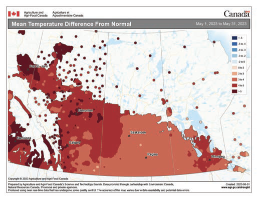
As for the entire spring, it had a brutally cold start across the Prairies, with March temperatures running far below average. April saw a bit of a warmup in the west. Alberta saw average to above-average temperatures while Saskatchewan and Manitoba continued to deal with below-average temperatures. Then May rolled in, with summer-like temperatures.
When the numbers are added and averaged, spring 2023 was colder than average simply due to the brutally cold March and April. Precipitation this spring was below average in nearly all regions. Only Peace River reported above-average amounts, thanks mostly to one wet day in May.
Looking ahead
The warmer-than-average end to spring didn’t make up for the cold start, but it does show how one month’s weather can override our impressions of a whole season.
What is the long-range outlook for summer?
We will start with the two almanacs. The Old Farmer’s Almanac calls for near- to slightly-above-average temperatures, with summer starting off dry and getting progressively wetter. The Canadian Farmers’ Almanac calls for near- to above-average temperatures in June followed by above-average temperatures in July, then back to near- to above-average temperatures in August. Precipitation looks to be near- to below-average, as it mentions storms along with dry spells.
Among the more reliable weather models, the U.S. NOAA calls for average temperatures and precipitation this summer, with Alberta possibly seeing slightly above average temperatures. The CFS model calls for well-above-average temperatures in June, cooling toward more average values in July and August. Overall, it calls for near-average temperatures across the southern Prairies with above-average temperatures over more northern regions. Precipitation is forecast to be above average this summer.
The CanSIPS model is taking a different tack, calling for well-above-average temperatures to continue all summer, with near average precipitation over western regions and below average precipitation in the eastern Prairies and far northern regions.
As for my prediction, I would be rich if I could accurately forecast summer weather. An accurate long-range forecast is literally worth billions. Always keep that in mind that when someone says they can predict the weather. Anyway, I lean toward the Canadian CanSIPS model, with its call for above-average temperatures this summer along with near- to below-average precipitation.