Forecast issued Feb. 11, covering Feb. 11 to 18, 2026
Highlights
- Weather models show the current weak, westerly flow holding in place, which means more quiet and mild weather
- Alberta should see warm conditions with little for precipitation before cooler conditions return mid next week
- Manitoba and Saskatchewan can expect generally sunny to partly cloudy skies and above-average temperatures
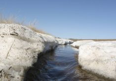
- Lack of precipitation is becoming a concern in some areas
Overview
If you enjoyed last week’s weather, you will likely appreciate this week’s forecast as well. Very little has changed in the overall pattern across much of western Canada.
Read Also
Prairie forecast: Cooler than average temperatures expected to continue
While temperatures will gradually trend upward as the Prairies move into spring, the overall cooler-than-average pattern remains firmly in place. Current indications suggest this will persist for at least the next 7 to 10 days.
Last week, an upper ridge brought near-record-breaking temperatures to parts of Alberta and western Saskatchewan before weakening and sliding off to the southeast. That shift finally helped dislodge the cold air entrenched over the eastern Prairies, allowing Manitoba to see above-freezing temperatures once again.
With the ridge collapsing, the Prairies were left under a weak westerly flow off the Pacific rather than the more typical mid-winter northwesterly flow from the Arctic. The result has been light to moderate winds and temperatures running above average.
More weather coverage: Last year was third warmest on record
While there were a few light dustings of snow, occasional periods of freezing rain and even the odd rain shower, overall precipitation amounts remained minimal.
For this forecast period, weather models continue to show that weak westerly flow holding in place. That means more quiet weather, with temperatures generally running several degrees above the long-term average for this time of year. The main storm track will stay well to our north, while weak high pressure dominates much of the Prairies. All of this adds up to a relatively short and straightforward forecast.
Alberta
Once again, the forecast is short and to the point. I would like to say short and sweet, but with many areas wishing for snow or any meaningful precipitation, there is unfortunately little relief in sight.
A weak westerly flow combined with a broad but weak area of high pressure will dominate this forecast period. Expect sunny to partly cloudy skies and above-average temperatures. Daytime highs across southern Alberta should range from 7 to 12 C, with overnight lows between -5 and 0 C. Central and northern regions can expect daytime highs in the 2 to 6 C range, with overnight lows near -5 C. These mild conditions are expected to persist through the weekend.
The main uncertainty over this forecast period involves cloud cover. At this time of year, under this type of pattern, low cloud can occasionally develop, particularly over areas that still have snow cover.
Early next week, models are hinting at a potential shift in the weather pattern as a strong area of low pressure pushes into the northwestern United States. If this system develops as projected, it is expected to gradually organize and track eastward around midweek.
Most of the precipitation currently looks to remain south of the province, with only occasional light snow possible across far southern regions. Behind this system, cooler air will filter southward. This should bring temperatures back toward more seasonable values by Tuesday and Wednesday.
Saskatchewan and Manitoba
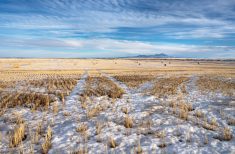
The forecast for Saskatchewan and Manitoba is similarly brief and straightforward. While the mild temperatures are welcome for mid-February, the continued lack of significant precipitation is beginning to raise some concerns.
With weak high pressure and a light westerly flow in place, expect generally sunny to partly cloudy skies and above-average temperatures. Daytime highs should range from 0 to +5 C, with the warmest readings across western Saskatchewan and the coolest across eastern Manitoba.
More weather coverage: Prairie weather all starts with the sun
These mild conditions, along with relatively light winds, are expected to continue through the long weekend, making for pleasant conditions for those heading outdoors.
Looking ahead to early next week, models indicate a strong but broad area of low pressure developing over the American Northwest. At this time, most of the system’s energy is forecast to remain south of the border. However, this far out, details can change, and it will be worth monitoring.
This system may mark the beginning of a transition toward a more active weather pattern as we move into the second half of the month.