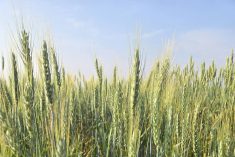
Alberta Agriculture and Rural Development’s website contains lots of information for those in the agriculture industry, including literally thousands of maps. “These maps contain all sorts of information related to climate and current conditions,” says Ralph Wright, soil moisture specialist, Alberta Agriculture, Edmonton. “Precipitation, temperatures, snow pack, soil moisture – these are just some of the areas the maps cover.”
In addition to the current maps, there are historical maps that date as far back as 1961.
“These historical maps can be very useful for understanding the current trends,” says Wright. “If you want to know what this year might look like, you can go back and look at the old maps to try and help put current patterns into perspective.”
Read Also
Cutbacks linked to drop in variety applications
The Plant Breeders’ Rights Office is receiving fewer applications for IP protection, for wheat and other cereal crop varieties
Wright says the map collection can even be a help when it comes to making marketing decisions. “Perhaps it’s dry in your area, but what is it like 100 kilometers away? It’s very useful to know what’s happening around the province where your markets may be.”
The moisture maps can also be very helpful when it comes to making insurance decisions. “The maps can show you what the historical trends have been for your area,” says Wright. “If there’s a strong gradient of precipitation in your area, for example, the maps will show that. And that sort of knowledge can be very helpful when it comes to deciding on insurance.”
To access the maps, go to www.agric.gov.ab.ca/acis