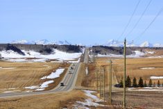
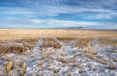
As I’ve been pointing out, spring is a tough forecast period as the atmosphere begins it transition from a winter to summer pattern. We’ve seen this happen repeatedly in recent weeks with temperatures warming for a few days and then dropping off once again.
When we have these battles between warm and cold air, there’s always a good chance for a storm system or area of low pressure to develop. We’ve seen this happen a few times this spring and looking at the latest medium range weather models, the Prairies are likely in for a few more storms as the battle continues.
Read Also
OPINION: Canada’s shifting snowpack reveals water-loss location matters for agriculture
From the Prairies to the Great Lakes, uneven snowmelt patterns signal new era of water supply risk.
We start this forecast period with a weak area of low pressure tracking from Alberta through southern Saskatchewan and Manitoba, bringing scattered showers and a few flurries over more northern locations. Behind this low, the weather models are showing a fairly strong upper ridge building over the western Prairies starting on Thursday. This ridge will bring very mild temperatures to Alberta and Saskatchewan on Thursday. It’s then forecast to push eastwards to bring the mild temperatures into Manitoba on Friday and Saturday.
Behind this upper ridge, two areas of low pressure are forecasted to develop: one over north-central Alberta and one over Wyoming. The Alberta low will bring some showers to central and northern Alberta late Friday and into Saturday. It will then drift into northern Saskatchewan and then Manitoba over the weekend.
The Wyoming low is forecasted to intensify and track northeastwards into Minnesota by Monday. Current indications are that extreme southern parts of all three Prairie province could see some rain—possibly changing to snow in some areas on Sunday and Monday. Confidence in the strength and exact track is low at this time.
Cooler air will work in behind the low on Monday, but it looks like another upper-level ridge will begin to develop. This will bring a return to warm conditions by the middle of next week.
Alberta
The remnants of a weak area of low pressure will bring a mix of sun and clouds on Wednesday along with the chance of a few showers. Temperatures look to be seasonable with daytime highs forecasted to be in the 10 to 12 C range. On Thursday the weather models are forecasting an upper ridge to develop which will bring sunny skies and warm temperatures. Expect daytime highs to be in the mid to upper teens, with a few areas possibly pushing into the low twenties. Overnight lows will also be mild with most regions staying above the freezing mark.
Over the weekend, the upper ridge will transition east. This will allow an area of low pressure to develop over north-central regions. This low will bring clouds and the chance of a few showers late on Friday and into Saturday. Some flurries are possible over northern regions as temperatures cool.
Further south, expect increasing clouds on Saturday and the chance of showers or light rain over extreme southern sections as moisture pushes northwards ahead of a develop low over Wyoming. These showers will move out by Sunday. Further north, expect a mix of sun and clouds with slight cooler temperatures as daytime highs are forecasted to be in the 8 to 12 C range.
By early next week, expect a return to sunshine and milder temperatures as another upper ridge begin to develop over the region.
Saskatchewan and Manitoba
The southern parts of both provinces will be dealing with clouds and showers, with a few flurries possibly mixing in on Wednesday as a weak low tracks through the region. Expect daytime highs to be in the 4 to 7 C range with overnight lows falling to around the freezing mark.
An upper ridge of high pressure is forecasted to begin building into Saskatchewan on Thursday. This will help to clear out the skies and boost temperatures. Expect daytime highs on Thursday and Friday to be in the mid to upper teens with a few low twenties not out of the question. This upper ridge will clear out Manitoba late on Thursday allowing for plenty of sunshine on Friday and daytime highs in the mid to upper teens.
Things look to get interesting over the weekend as an area of low-pressure winds up over Wyoming. Confidence in the track and strength of this system is low at this point, but current indications are it will move from Wyoming to central Minnesota by Sunday.
The system is forecasted to bring rain to extreme southern parts of both Saskatchewan and Manitoba on Sunday. The rain may change to snow overnight Sunday and into Monday morning. The system will move out by Tuesday bringing a return to sunshine but cooler temperatures. Luckily the cooler temperatures don’t look like they will stick around for long. Milder temperatures are forecasted to move back in by Wednesday thanks to a developing upper-level ridge.