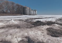
Fields across Western Canada are in desperate need of some precipitation ahead of winter freeze-up, but time is running out.
Freeze-up usually occurs sometime between the end of October and mid-November and while some regions have seen some precipitation, most areas are very dry, said Bruce Burnett, weather analyst with CWB.
The snowfall picture for Western Canada is improving, said Drew Lerner, weather specialist with World Weather Inc. in Kansas.
Lerner recently changed his winter precipitation forecast for Western Canada because the influence of El Niño in the region is starting to wane. If El Niño was still a strong presence, it would be a dry winter. Lerner now predicts near- to below-average precipitation with warmer-than-average temperatures.
Read Also
Nortera’s Lethbridge plant closure ends 75 years of frozen vegetable processing in southern Alberta
Quebec-based Nortera Foods is closing its Lethbridge frozen vegetable facility in June as part of a strategic restructuring, ending 75-year processing run in region.
“I think we’ll have adequate snow during the coldest periods, but the depths are definitely going to be low,” Lerner said. “And when we come into spring the moisture in the topsoil will probably be a little below average.”
And soil moisture levels next spring will be lower than they were this past spring, he said.
Snowmelt would improve moisture levels, but frost will most likely prevent it from penetrating the soil.
Farmers are going to have to be patient, Lerner said.
“We will need a greater amount of precipitation to restore topsoil moisture before we can get into planting some of these areas in the spring of 2013,” he said. “I think we’ll get it, but it may not come right away.”
When precipitation does come, it will probably be abundant — perhaps too abundant, he added.
“We don’t want too much moisture when we’re trying to access the fields,” he said.