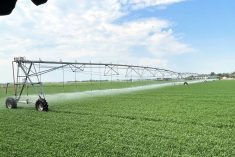
Irrigated crop producers in southern Alberta have great news for the upcoming growing season, with early projections showing the best snowpack in years.
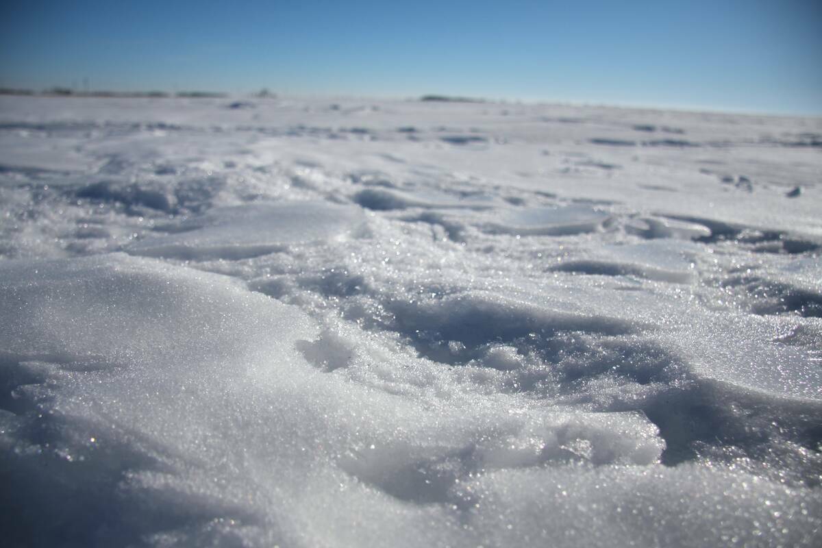
“Based on the snowpack and groundwater conditions, the forecast is about 104-107 per cent of normal volume for the period of March through Sept. 30. If you look at a year ago, it’s all about 70 per cent. So we’re about 30-40 per cent more volume prediction right now for the same period of time,” said Dennis Matis, operations and infrastructure manager for the Oldman River Basin, Water and Infrastructure and Operations Branch, and Alberta Agriculture and Irrigation, at the January Irrigated Crop Production Update in Lethbridge, Alta.
WHY IT MATTERS: Snowpack projections help dam operators, irrigation districts and farmers alike project allotments for producers with irrigated crops with how much capacity reservoirs will have.
Read Also
Prairie spring forecast: What weather models predict for March to May
Weather models offer varied outlooks for Prairie spring. This forecast review compares Old Farmer’s Almanac, NOAA, CFS, CanSIPS, and ECMWF predictions for March through May temperatures and precipitation.
Those preliminary predictions are strengthened by “snow pillows” used for measuring snowpack located throughout the region featuring readings well-above median. The upper St. Mary/Waterton flat top, upper Oldman/Castle headwaters, Oldman/Crowsnest, North Fork, Sunshine and Skoki all have between 130-160 per cent above median.
“The skiers at Norquay are having a heyday right now,” said Matis.

The strong numbers hope to be a breakout from the last decade, which has seen well-below average supply for the Oldman and St. Mary reservoirs. Inversely, demand between 2017-2025 has been well-above average despite top-10 lowest Oldman inflows in the last quarter century.
“As dam operators, the last 10 years, I dare say our team had done a really amazing job with the very little water we have. We have been able to supply districts’ needs. We haven’t had any deficits on the in-stream flows for the most part. Timely rains helped us big time time,” said Matis.
“It’s a lot of interim forecasts, projections, running models — really trying to optimize every drop.”
Climate change has seen water come at different times and in different forms, be it rain or snow in variability. Traditional peak runoff from melt is usually mid-June, whereas the last few years has hovered around the mid-May range, which dam operators must monitor closely. High winter inflows had a rare month in 2025 of between 35-40 centimetres into the Waterton dam, which mirrored an occurrence in 2021.
Season-ending storage for St. Mary Reservoir was 138,000 cubic decametres, but gained 109,000 cubic decametres from the winter inflow from Oct.-Jan.
“That’s probably going to be a record, I think at least in the last 40 years, for winter inflow. When you look at the average winter demand, winter influence is 26,000,” said Matis, adding Oldman Reservoir gained 45,000 cubic decametres for winter inflow, shattering previous averages.
“We’re actually looking at our operating policies, and we’re really integrating this whole winter phenomenon right now. If this continues, do we rely on it regularly?”
Oldman Reservoir low-supply projections up to May 1 is 300,000 cubic decametres (60 per cent full) with a high-supply scenario of 68 per cent full. St. Mary Reservoir projected ranges are between 270,000-301,000 for supply scenarios, at 75 to 82 per cent full, aided by high releases from Sherburne Reservoir in Montana from December and January. Waterton Reservoir ranges from 50,000-62,000 cubic decametres at 44 to 54 per cent capacity.
All are at up to normal to upper quartiles, trending higher from 2023 after major reservoirs dropped to historically low levels over the last half century.
Seasonal forecasts have below-average temperatures in the early part of the year coupled with above-average precipitation from January to March. It shifts to normal temperatures and below-average precipitation from April to June. A La Nina year is projected with a colder winter and more precipitation.
“We should be able to fill our reservoirs; 2026 is shaping up to be the best year probably in 10 years,” said Matis.
“Snow and precipitation is always an uncertainty, but it’s looking pretty good early on right now.”
Field data is taken is taken from 400-plus water stations with 146 model forecast points. Data is also taken from 620 meteorological stations.