From a meteorological point of view we have officially entered into fall (September, October, and November). After a mediocre summer across most of the Prairies, the big question on most people’s minds is whether we’ll be treated to a nice warm fall or will winter make early inroads bringing more cold than mild weather this fall.
Before we take a look at what the different forecasts are saying I thought we could take a bit of a look back over the last five or so years to see what kind of fall weather we’ve been seeing across different parts of Alberta.
Read Also
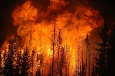
Prairie weather all starts with the sun
The sun’s radiation comes to us in many forms, some of which are harmful to organic life while others are completely harmless or even essential, Daniel Bezte writes.
Starting in the Edmonton region, they’ve seen fall start off warm and dry for the most part, and then it seems to transition into a dry and near- to slightly below-average temperatures by the middle of fall. The end of fall for this region has been a mixed bag, but overall, near-average temperatures with a little below average amounts of precipitation seem to win out.
Farther south, the Calgary region has seen most of the last five or so falls start off warm and dry, with average temperatures and precipitation being the worst start to fall. As fall moves on it starts to become a bit of a dice roll, with a pretty even split between cold and wet middle falls and warm and dry ones. The end of fall is a little like Edmonton in that there is quite a mixture of conditions, but overall, near-average temperatures and below-average precipitation have been the most frequent.
The long range
Now on to the long-range fall forecasts!
For these I’ve decided to go with five main long-range weather forecasts plus my own forecast. For those of you who have not followed any of my previous long-range forecasts, I need to point out that while forecasts going out as long as 15 or so days have improved a fair bit over the last 10 or so years, the monthly and seasonal forecasts are still not very reliable. We still do not understand enough about how all the different factors that drive our weather work and interact with one another to create reliable long-range forecasts.
So why does everyone create long-range forecasts? That is a darn good question! First of all, if you don’t keep trying then you will never be able to do it, but beyond that I would say that it is a bit like betting on a horse. The forecasters take a shot at what the weather might be like by looking at different weather tips (patterns they see and current weather conditions around the world). They combine this with their intuition and then make their best guess on how it will turn out.
If they are wrong then oh well, they will come up with a good reason why. If they are right, then pats on the back all around and bragging rights until the next long-range forecast comes out.
The predictions
OK, here we go. According to the Old Farmer’s Almanac, this fall is going to see near-average temperatures with below-average precipitation. I think I could handle that.
Over at the Canadian Farmers Almanac they are calling for colder-than-average temperatures with above-average precipitation. Turn that into general day-to-day weather and that means cold and wet to start the fall with conditions turning to cold and snowy by the time the middle of October rolls around. I don’t think I like this forecast very much.
Our next forecaster is good old Environment Canada. According to them we should see above-average temperatures this fall with near-average precipitation over northern regions with above-average amounts in the central and southern parts of the province. I kind of like the above-average temperatures but I think southern and central regions would probably not want to see above-average amounts of rain.
The Weather Network is calling for similar conditions as Environment Canada except that they are only predicting near-average temperatures instead of the above-average ones.
Last but not least on our list of official long-range weather forecasts is AccuWeather. According to its latest fall forecast we are expecting to see below-average temperatures this fall along with near-average precipitation over southern and central regions with above-average amounts in the north.
Now it is on to my long-range forecast. To me fall is one of the most difficult periods to forecast as the battle between warm and cold air kicks into high gear. I have to admit I go purely on gut feelings, and my gut is saying that the first half of fall we’ll see warmer- and drier-than-average conditions. This will then transition into a cooler and wetter pattern as we get deeper into fall, but whether that pattern will continue to the end of fall is anyone’s guess. If I have to go out on a limb then I’ll say that most places will be seeing an early start to winter.
There, now that I said it the opposite will probably happen. Either way I hope that fall brings whatever type of weather you hope for this year.