A couple of articles ago I discussed how April can bring some of the biggest dumps of snow. Little did I know that was exactly what was going to happen this month. In fact, I received a couple of emails from people jokingly saying that I jinxed this April’s weather by talking about snow.
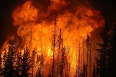
So for this issue I decided to move away from any talk of cold and snow and look at a summer topic, thunderstorms and tornadoes. Given the time of year it would be quite rare to see any tornadoes, so I think I’m safe on that subject, and since most thunderstorms require lots of warmth I think a number of us would put up with the odd storm if it meant warmer temperatures.
Read Also
Prairie weather all starts with the sun
The sun’s radiation comes to us in many forms, some of which are harmful to organic life while others are completely harmless or even essential, Daniel Bezte writes.
How can you know if a storm is producing severe weather? The answer is not that easy. The first thing is to listen to Environment Canada for watches and warnings. If a watch is issued by EC it means that there is potential for severe thunderstorms, but they have not yet developed in your area. When you hear that there is a watch you should watch the sky for any development, and if any storms do develop they have the potential to become severe.
If EC issues a warning, this means that a thunderstorm with some or all of the characteristics of a severe storm has already developed and has been confirmed by eyewitness or radar. This means that you should take precautions immediately.
If you are out in the field without access to a radio what can you watch out for? First of all, recognize the conditions – how warm and humid is the air? Remember, a moist atmosphere means there is a lot of energy available. Look for a dark or threatening sky – look closely at the area between the storm and the ground, if you can see through it, the storm is likely not severe yet. Lots of lightning or nearly continuous thunder is a good indication of a severe storm. As the storm approaches, keep an eye out for things such as a green sky and mammatus clouds (clouds that look like bag-like sacks that hang beneath a cloud). These conditions usually indicate that the storm contains huge amounts of water and has very strong updrafts and downdrafts.
Tornadoes
Finally, watch out for any kind of rotation within the storm. This means the storm has become very strong and has the capability of producing a tornado.
The word tornado for most people brings about a feeling of awe and even a little fear. Unless you have already witnessed a tornado first-hand, many who are interested in weather secretly wish they could safely experience the awesome beauty and power of a tornado.
Worldwide, Canada is second only to the United States in the number of tornadoes that occur each year, with an average of about 70 reported. Southern Ontario experiences the highest number of tornadoes, followed by southern Manitoba, Saskatchewan, and central Alberta. While these areas report most of Canada’s tornadoes, they have occurred in nearly all regions of Canada.
Tornadoes can strike at any time of the year, but in Canada, tornado season runs from April to October, with the peak months being June, July and August. This differs from the U.S., where tornadoes peak in April and May. This is due to the amount of cold air that is available for severe storm development. In the spring, the southern and central U.S. has become quite hot, but cold air is still closely available to help develop thunderstorms. By midsummer, most of the cold air has retreated well into Canada, putting our region in warm conditions, however we still have cold air fairly close by to our north.
A classic definition of a tornado is a violently rotating column of air that extends from a thunderstorm to the ground, and may or may not be visible as a funnel cloud. For this rotating column of air to be classified as a tornado it must touch the ground.
As to how tornadoes form, the real answer is, we just don’t know. Tornadoes usually develop from super-cell thunderstorms, which are difficult to predict. Even if we were able to accurately predict where and when these thunderstorms would develop, the intense part of the thunderstorm usually only covers an area of a few hundred square kilometres. Within this few hundred square kilometres, the really severe weather may only occur in a small area of maybe 10 to 20 square kilometres. Now, if we look at the size of a tornado, we would find that they range from as small as about 40 metres to as large as two km across, with the average width being around 100-200 metres. This means that, as far as weather phenomena are concerned, tornadoes are very small. This makes them very hard to study first-hand.
Unfortunately, this all the room I have for now, so more on this in our next article.
———
InCanada,tornado seasonrunsfromApril toOctober,withthe peakmonthsbeing June,JulyandAugust.