Producers are always being pitched new technology, and the marketing din is arguably louder than ever in this age of precision agriculture.
So when producers ask if unmanned aerial vehicles are just expensive toys, it’s a fair question.
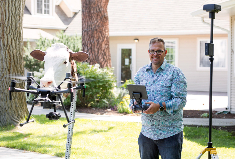
While John Church would be the first to admit he has a lot of fun researching the capabilities and limitations of drones on pasture land, the work he’s doing is quite serious. Outfitted with sophisticated imaging technology, these mini-helicopters become powerful monitoring and data-gathering tools for cattle and pasture health.
Read Also

Alberta producers set record for environmental farm plans in 2025
Albertan farmers and ranchers completed a record number of Environmental Farm Plans in 2025.
“We place multispectral and near-infrared cameras on drones to monitor the health of crops and pastures while also using them to monitor cattle — to find them, look at them, read their ear tags or see if they’re calving,” said Church, a researcher with Thompson Rivers University in Kamloops, B.C.
“They’re really becoming flexible tools.”
They are also becoming more affordable. A drone set up with all of the equipment needed to become a pasture management tool costs under $10,000, said Church. And that can pay off quickly even if it prevents the loss of only one or two cows annually, he said.
“Now, for around the same kind of money you would pay for a new ATV, you can have your own personal helicopter you can fly as much as you want, which is remarkable because you used to have to drop $30,000 to even consider getting in the game,” he said.
“The drones I’m purchasing today may cost 10 per cent of what I spent five years ago yet the flight times, the stability and the image transition are incredible.”
Precision is key
The ‘expensive toys’ accusation is, in fact, partially true.
While drones go for as little as $40 at big-box retail stores, one capable of being a serious management tool costs a lot more
“The main difference is the image and the stability,” said Church. “The better drones are pre-equipped with GPS systems that really allow the drone to know where it is and hold itself in place.”
Expect to pay between $2,000 to $5,000 for a robust, camera-ready unmanned aerial vehicle, he said. One with a sky port allows different kinds of cameras with different data-collecting abilities to be swapped in or out.
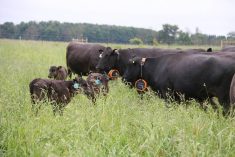
Multispectral cameras use spectral imaging (which measures how a given object reflects light from the sun) to determine the health of a crop. In a nutshell, healthy plants reflect light differently than unhealthy ones, which allow these drones to identify which pastures are best for grazing.
These near-infrared remote sensors can collect data on soil and plant health before there are visible signs of plant stress, said Church, adding the results have been enlightening.
“We are finding a relationship between the amount of carbon stored in the soil and overall plant health.”
Multispectral imaging is essentially the same technology satellites use to measure a range of factors on Earth.
So why not just use the data from the satellites? The difference is the degree of precision, said Church.
“The main difference between drones and satellites is that drones can go low and slow in terms of mapping,” he said. “We can fly at incredibly slow speeds at really low heights. I typically fly anywhere from 50 to 70 metres above ground so we can get much better spectral resolution. Someone operating a conventional aircraft could only dream of flying that low.
“We’re almost at the point where we can gather data on individual plants. When you’re using satellites you’re collecting information on a scale of 10 metres per pixel while we are down to centimetres per pixel — and in some cases even sub-centimetres per pixel — using drones.”
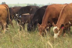
Presently, the ‘killer app’ of drones on pasture is monitoring cattle.
Both conventional and thermal cameras can track the location of animals while thermal cameras go the extra step of checking the condition of individual bovines.
Although the latter is still a bit of a work in progress, drones are excellent at pinpointing cattle location, said Church.
“If we just want to extend our vision by say, looking over a ridge, looking in a group of trees for a group of cattle or checking to see if there is water in the trough at the other end of the field, they are really good at doing that.”
One thing drones are not so good at, said Church, is acting as “digital border collies” to herd cattle.
“As soon as you start moving cattle (with a drone), in my experience they think they need to run from it.”
‘Smart cows’
Using zoom lenses, Church said he can currently read ear tags with a conventional camera from as high as 70 metres. However, he said the monitoring technology will have to evolve further to take full advantage of drones’ capabilities.
One of the biggest asks on Church’s wish list is the ability to read cattle’s radio frequency identification (RFID) tags from the air and access their information immediately. He has been researching this capability with SAIT over the past year. Although something similar can be achieved right now, Church said it’s a two-step process of downloading the information from a GPS collar and placing it on a GPS map.
What we need, said Church, is “smart cows.”
“We’ve heard of smart fridges and the Internet of Things. I think in the future we are going to be moving into the ‘Internet of Cows’ and I think the time is coming where the animals will have smart tags and smart collars which will allow us to get advanced metrics from the air.”
Although still a blue-sky idea, it’s getting closer.
“We need to get to a place where we can open up our computer screens and see where our cows are in the pasture in real time. I think that’s a dream that isn’t far away, although it remains for the most part elusive.
“Wouldn’t it be great if, for example, we had a three-axis accelerometer on a cow’s ear tag or on its collar and if it starts vibrating we get a text alert on our cellphone telling us something is happening to Cow 83 and I can fly it exactly to where Cow 83 is? Is she snagged up to a bush? Is she alive? What’s going on?”
Learning to fly
Aside from price, two common questions producers ask Church are, ‘How do I fly this thing?’ and, ‘What qualifications do I need?’
Earlier this year, Transport Canada began enforcing new regulations pertaining to drones. All pilots flying drones that weigh between 250 grams and 25 kilograms must get a drone pilot certificate. These fall into two categories: basic and advanced operations. Those seeking the latter must pass the small advanced exam and in-person flight review.
“For most people a basic licence is just fine,” said Church.
Transport Canada has a list of drone flight schools which follow the department’s standards. Classes are particularly recommended for anyone seeking an advanced licence. Otherwise, this is an area where those cheap big-box drones may come in handy, said Church.
“I always tell people if they want to learn to fly they should get a micro-drone or ‘toy drone’ for around $40,” he said. “They’re excellent training devices, partly because it’s much harder to control them than the real thing. Many of them are now packaged with flight simulator software to help you learn the basics of flying before flying the drone for real.”