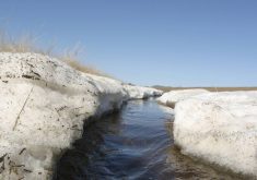
Did I ever mention forecasting in spring can be a real pain in the you know what?
We saw evidence of this in the last forecast when a large storm system moved in off the Pacific. The northern portion of the storm system brought widespread and significant snowfall to north-central Alberta. It then proceeded to track into northern Saskatchewan before weakening as it entered northern Manitoba.
Meanwhile, the southern branch of the storm developed into a Colorado low—which then proceeded to not behave like a typical Colorado low. This low ended up tracking further east than expected and had little to no impact on Manitoba, except for some mild temperatures last Friday.
Read Also

Pulse Weekly: SaskPulse optimistic despite input, crop price concerns
SaskPulse executive director Carl Potts is optimistic ahead of the planting season despite lower crop prices and the war in Iran.
For this forecast period the weather models are showing a fairly quiet weather pattern will only a couple of chances of light snow as weak systems track along the boundary between the cold Arctic air to our north and milder air to the south. This is the big question mark for this forecast period: just where will this boundary be? Currently it looks like it will run roughly from northwestern Alberta, southeastwards into southern Manitoba.
It looks like the system is going to drift back and forth a couple of times, which will make temperature forecasts for the regions near the boundary a little tricky. Also, when weather systems are weak, the timing of these systems can easily change so confidence in the finer details of this forecast is lower than usual.
Alberta
Weak high pressure will bring sunny to partly cloudy skies on Wednesday with daytime highs across southern regions in the 7 to 10 C range. Further north, expect daytime highs to be in the 3 to 5 C range. On Thursday, a weak area of low pressure is forecasted to push in off the Pacific and track through south-central Alberta. This system looks as if it will mostly bring some clouds with maybe the odd flurry.
Skies will try to clear out on Friday before a second area of low pressure is forecast to drop southeastwards from northern B.C. and through the province on Saturday. This system will be much like Thursday’s system with most regions simply seeing more clouds than sun with the chance of some flurries or showers depending on the timing of low.
Some weak upper-level ridging is forecasted to begin building in on Sunday. This should push daytime highs into the low to mid teens across the south with highs over central regions pushing 10 C. A third low is then forecasted to cut through central regions on Tuesday bringing more clouds and some showers or flurries. This system should be out of the province by Wednesday with the weather models then showing a continuation of the slightly milder than average weather continuing.
Saskatchewan and Manitoba
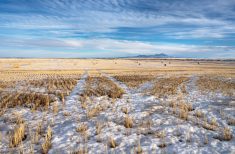
It is a cooler forecast for these two provinces as the boundary between cold arctic air and warmer Pacific air sets up across these regions. The boundary looks to stretch from the Battlefords to around Winnipeg. Areas near and to the north of this boundary will see sub-freezing highs on Wednesday. Those to the south will see highs in the 2 to 4 C range. The warmest temperatures are expected for southwestern Saskatchewan.
An area of low pressure will track out of Alberta on Thursday and will be in Minnesota by Friday. Southern regions of Saskatchewan and Manitoba will see a quick shot of warmer air with daytime highs forecasted to be in the 4 to 7 C range. Extreme southern regions may see the odd shower or flurry as this low tracks by. Behind the low, Arctic high pressure will drop southwards and bring much colder temperatures on Friday and Saturday. Expect daytime highs on Friday to struggle to make into to around -10 to -8 C with overnight low dropping to around -20 C. Strong spring sunshine will help to warm things up a little bit on Saturday with highs expected to be in the -5 C range.
Another weak low is forecasted to drop southwards out of Alberta late on Saturday and then track through the Dakotas on Sunday. This system looks as if it will bring some clouds and light snow or flurries to the southern portions of Saskatchewan and Manitoba. Once this system moves by, upper-level ridging to the west will help to push temperatures back above the freezing mark to start the week.