This map shows the total amount of precipitation, compared to average, that has fallen across the Prairies during the 60-day period ending Nov. 7. This gives us a good idea of moisture levels heading into freeze-up. The map shows a large portion of the Prairies has seen above-average rainfall (blue regions) with the wettest areas found in Saskatchewan and western Manitoba. The only below-average areas are found in south-central Alberta and extreme far northwestern Alberta.


Will it be a typical La Niña winter on the Prairies this year?

La Niña usually brings more snow and colder temperatures, 
but some forecasts are painting a different picture for this year

Reading Time: 3 minutes After nearly 11 months of global record-setting temperatures, North America has had its turn seeing the warmest weather on the planet — at least when compared to average. I’ll have to admit: It really bugs me when people use the infamous line, “Where is global warming now?” every time temperatures in their region are colder […] Read more

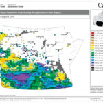
This map shows the total amount of precipitation across the Prairies during the first two months of this summer as a departure from average. Areas that are dark yellow to brown have seen below-average amounts; light-yellow, blue and green areas are near average; and dark-green, blue and purple areas have seen above-average amounts. You can see a large portion of the Prairies has been relatively wet, with southeastern Alberta and southwestern Saskatchewan being the wettest, receiving between 100 millimetres to more than 120 millimetres more precipitation 
than average.

There’s a lot of truth in many sayings about the weather

Ones that predict what’s going to happen in the next little while 
make a lot of sense, but long-term predictions are pretty iffy
Reading Time: 3 minutes There are a number of different weather sayings, and weather folklore, that have their base in sound weather principles. For example, one of the most well-known sayings is, “Red sky at night, sailors delight. Red sky in the morning, sailors take warning.” This saying works pretty well and makes sense if you live in the […] Read more


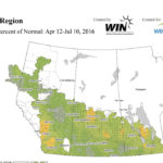
This map shows the total precipitation across the Prairies over the last three months. Most areas have seen near to slightly above average rainfall so far this growing season, with only southern and central Alberta seeing below-average amounts.

Our heads are in the clouds

Having trouble sorting out cumulonimbus, stratocumulus, 
and nimbostratus? Here’s your cloud-spotting guide

Reading Time: 3 minutes I’m currently off exploring the mountains of southeastern B.C. and southwestern Alberta and due to my travels, will have go with a more generic weather article this issue. I decided to take a look at something that ties into pretty much all of our weather — clouds. If we were to define a cloud, we […] Read more

This map shows total precipitation in Alberta so far this growing season (up to June 21) compared to the long-term average. The Peace and northern regions have seen average to well-above-average amounts of precipitation so far this growing season. In the central and southern regions, eastern sections have seen near-average amounts while western regions have been dry to very dry.


Clearing up the confusion about humidity

The term ‘relative humidity’ is commonly used, but most people 
don’t know what it means and why it’s misleading

Reading Time: 4 minutes As we move into the heart of summer and with all this moisture around in many regions, I think it’s time to revisit one misunderstood concept — humidity. To be more specific, we are going to look at exactly what humidity is, how we measure it, and how it is reported and interpreted. The simplest definition […] Read more


This map shows the total amount of precipitation that fell across the Prairies compared to average during the 30-day period ending on June 9. It is evident that this has been a fairly active period, with a large portion of all three Prairie provinces showing near- to above-average amounts of rainfall. The wettest regions were found in Alberta, stretching from Grande Prairie southeastwards towards Coronation and western Saskatchewan and southeastern Saskatchewan to southwestern Manitoba. Interestingly, north-central Saskatchewan was very dry during this period.

It’s that time of year when severe summer weather and tornadoes can form

Tornadoes have occurred in nearly all regions of Canada — 
here is what to look for when a severe storm is approaching
Reading Time: 3 minutes As we enter the peak season for severe weather across the Canadian Prairies, I figured now would be a good time to continue our look at severe weather and tornadoes. While Alberta doesn’t see the same number of tornadoes relative to areas to the east and south, the province is still subject to these events. Before […] Read more

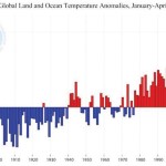
This chart shows the global monthly temperature anomalies for the first four months of this year compared to previous annual anomalies, which show the 
year-to-date temperature anomaly is running well above the previous record-warm year.

The global weather scene is heating up like never before

April was the 12th month in a row where the 
all-time monthly temperature record was broken
Reading Time: 3 minutes Psychologically, May might have felt cool — especially compared to the extremely warm start Alberta has seen this year. But overall, May was still warmer than average. This makes it the eighth month in a row with above-average temperatures in all three of our main regions (Peace River, Edmonton, and Calgary). For those of you who […] Read more


This map shows the total amount of precipitation that fell across the Prairies during the first 28 days of this year’s growing season. You can quickly see that a large part of Alberta and Saskatchewan had a dry start to the growing season. In contrast, southeastern Alberta, southwestern Saskatchewan, and much of central and eastern Manitoba have been much wetter.

The heat’s been on for months — and there’s no end in sight

You could almost say winter ended three months ago, 
and the long-range forecasts are for more hot, dry weather
Reading Time: 3 minutes It’s been a rather remarkable spring across Alberta this year. Looking back at the weather records for 2016 you could almost say that spring arrived in February, with temperatures running over 6° above long-term averages. Those mild temperatures continued into March, with mean temperatures that were around 5 degrees above average. The big question after such […] Read more

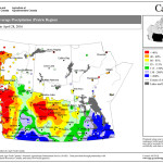
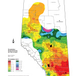
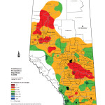
This map shows the total amount of precipitation that fell across Alberta during the 30-day period ending on April 11. Southern and central regions, for the most part, were very dry, with most regions seeing less than 10 millimetres. The central and northern Peace Region was also quite dry. The wet areas were in the extreme southwest along with the Northern Region, where more than 55 millimetres of precipitation were reported in some areas.

An early spring may lead to an early start to thunderstorm season

These awe-inspiring storms are associated with hot, 
humid days — but they can form under other conditions, too
Reading Time: 3 minutes With a pretty warm first half of April across Alberta I won’t be surprised if we end up seeing an early start to thunderstorm season. So I figured that maybe we should have an early start to my annual look at thunderstorms. To begin with, we’ll need to talk about one of my weather pet peeves, […] Read more


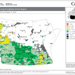
This map shows the total amount of precipitation for Alberta during the first three months of 2016, relative to the long-term average. You can see southern and central regions have been the driest, with amounts ranging from near average in a few areas to the driest conditions just south of Calgary. Farther north, amounts are mostly near average, with some above-average conditions in the northeast.

A big-picture look at why this winter was so unusually warm

An ongoing battle between a western ridge and eastern trough explains why Alberta has been warmer than average for so long
Reading Time: 3 minutes No matter which way you look at it, winter is over across agricultural Alberta — and it was definitely a warm one. While it won’t go down in the record books, Alberta’s been in a persistently long warm spell with seven consecutive months of above-average temperatures recorded at all three of the main locations. Winter […] Read more

This map shows the total amount of precipitation compared to average for the agricultural year which started in September 2015. Even with the light snow cover this winter, thanks to a wetter-than-average fall, precipitation amounts are around average across most of the Prairies. The exceptions are in parts of west-central Manitoba and northwestern Alberta.

Could this be one of the warmest springs on record?

AccuWeather is forecasting an exceptionally warm and dry spring — 
and it has good reasons for making such a bold prediction

Reading Time: 3 minutes AccuWeather came out early in February with its spring weather prediction, so I figured that maybe I should join in and take a look at what the different forecasters are calling for this spring. After all, meteorological spring starts on the first day of March (March-April-May). In what I think is a pretty bold move, AccuWeather […] Read more