Hot, sunny weather around the province through much of July made for ideal BBQ and beach weather — but bordered on too much of a good thing for some Alberta crops.
With the exception of the fairly wet Lake Country, farmers around almost the entire province hoped for rain when the low-pressure system blew through July 24-25. Despite the recent cooler, wetter weather, northern areas that faced deep drought conditions through the first three weeks of July have already suffered at least some irreparable crop yield loss, said Harry Brook, a crop specialist with Alberta Agriculture and Rural Development.
Read Also
Prairie spring forecast: What weather models predict for March to May
Weather models offer varied outlooks for Prairie spring. This forecast review compares Old Farmer’s Almanac, NOAA, CFS, CanSIPS, and ECMWF predictions for March through May temperatures and precipitation.
“Chances are that rain now will help somewhat. However, crop yield potential is set around the four- to six-leaf stage. I expect lower-than-average crops (in drought-hit areas) but rain now will help some of the crop to fill,” he said.
As of July 15, 77.4 per cent of the province’s total crops were rated in good to excellent condition, according to the ARD crop report. Specifically, between 77 and 82 per cent of spring wheat, oats, barley, lentils and dry peas; 88 per cent of dry beans; and 74 per cent of canola acres were at good to excellent condition.
Despite the seemingly high ratings of good to excellent condition, these totals were down by six per cent from the June 30 crop report, due almost entirely to heat and drought in the Peace and central regions. And the per cent of crop rated good to excellent is expected to fall further because of heat and drought in July.
- More Weather from the Alberta Farmer Express: Eastern Sask. keeps its cool
The good news, however, is that the large low-pressure system that moved across Alberta on July 24-25 was a “game-changing system,” said Alberta Agriculture soil moisture specialist Ralph Wright. “Southern Alberta needed a shot; the central parts of the province needed some; (and) of course, the Peace was quite desperate. This was a very necessary time to get rain, especially for the driest areas.”
The system centred on the Edmonton area, dumping 60 millimetres or more from Redwater in the north to Wetaskiwin and Mundare in the south. The hardest-hit area was Thorsby, which saw 98 millimetres fall inside of 48 hours. To put this amount in perspective, the entire month of July’s average rainfall for the Edmonton area is 100 to 120 millimetres.
Central Alberta also received a good share of rain — about 20 to 30 millimetres in the southernmost areas and 60 to 70 millimetres farther north.
“The Camrose, Flagstaff, Stettler areas were pretty dry prior to the system moving through,” said Wright. “They weren’t seeing major issues compared to the Peace region but the rain certainly alleviated moisture stress that may have been developing.”
In the south country’s dryland areas, certified seed grower Greg Stamp of Enchant was watching the sky on the Wednesday prior to the system moving into the province.
“Earlier-planted crops are doing OK, but the later-planted crops are struggling because the taps just sort of shut off on them,” said Stamp. “We were lucky with when we planted our dryland crops because we got our faba beans and peas in, in April. But anyone who planted into May might be suffering.
“Looking around at the fields in my area, canola looks stressed — there’s more of an orange tinge in the crop — and some winter wheat looks stressed. And I’m seeing some premature ripening in cereals in some spots, especially on hills in the dryland.”
Cooler weather later in July helped after a couple of weeks of +30 C temperatures.
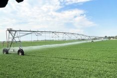
“Even in the irrigated areas, you can’t give the crop enough water to keep up with its use when it’s that hot. And the dryland, unirrigated areas? Those crops just wilt.”
Unfortunately for Stamp and other producers in his area, the low-pressure system produced little rain south of the TransCanada Highway, and warm, dry weather is forecast looking into the near future.
Those happiest to see rain-filled skies were producers in the Peace and central regions. Prior to the rain, the portion of the crop rated good to excellent dropped by 7.5 per cent between June 30 and July 15 in the central region, and was dropping further due to drought conditions. The Peace Region fell even further in this time period: a costly 11.7 per cent, leaving just over half the crop in good to excellent condition.
Moisture reserves captured from the heavier-than-average winter snows helped earlier in the season in the Peace Country. However, as of June 22, parts of the Peace Country were dealing with a level of dryness seen only approximately every 50 years. Throughout the dry central parts of the region, just 10 to 25 millimetres of precipitation fell between June 22 and July 22, far less than the inch of soil moisture that a crop needs per week to sustain good growth. Rycroft, for example, saw just 63 millimetres fall between April 1 and July 9, just over one-third of what usually falls during this period.
During the July 24-25 storms, the Peace Country received variable rain, from less than 10 millimetres near the town of Peace River to as high as about 50 to 60 millimetres in the MD of Smoky River.
“It sure would have been nice to get 50 to 75 millimetres across the Peace,” said Wright. “What it did get is not as much as was expected, but it’s still good. Anything is certainly better than nothing.
“It was enough to buy some time.”


