Forecast issued October 15, covering Oct. 15 to 22, 2025
Key points:
- An active weather pattern means the Prairies are likely in for another temperature rollercoaster.
- For Alberta, this forecast period is expected to be bookended by sunnier skies and near-average temperatures.
- A low is headed toward Manitoba and Saskatchewan and could bring significant rainfall to eastern Saskatchewan and western Manitoba.
Conditions across the Prairies
Last week’s forecast played out pretty close to what the weather models were predicting. As usual time of the year, and with an active weather pattern, the timing and location of the main systems was a bit off.
Read Also
Prairie forecast: Arctic air dominates the forecast
For this forecast period, it appears we will need to wait a little longer for spring to arrive. Weather models continue to show a northwesterly flow across the region, but this time the dividing line between mild and cold air has shifted slightly farther south. As a result, near to below-average temperatures are expected across much of the Prairies.
The active pattern that we saw last week looks to continue into this forecast period which means more chances for rain, possibly some wet snow and a continuation of the temperature rollercoaster ride.
This forecast period starts with three systems impacting the Prairies.
The first is a large area of high pressure over the central Prairies, which is bringing sunny to partly cloudy skies and near average temperatures. The second system is an area of low pressure tracking eastwards out of the southern Yukon. The third system is an area of low pressure currently deepening over the American southwest. This low is forecasted to lift northeastwards towards Saskatchewan and Manitoba and to bring what looks to be several days of wet weather.
Over the weekend, the eastern Prairie low is forecasted to drift off to the east. This will allow colder air to invade the Prairies and to bring a few days of below-average temperatures — especially over the eastern Prairies.
Out west, a trough of low pressure is forecasted to push in off the Pacific. This will bring a return to milder temperatures as southerly winds ahead of the trough bring in milder air. This trough is then forecasted to span an area of low pressure over central Alberta on Sunday or Monday, bringing clouds and the chance of some showers or wet snow.
The low is expected to quickly drop to the southeast. This will bring a return to sunny or partly cloudy skies and average temperatures right across the Prairies over the last few days of this forecast period.
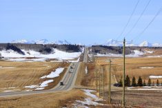
Alberta
With weak high pressure in place, expect to see sunny to partly cloudy skies and near to slightly above-average temperatures to start off this forecast period. Expect daytime highs to be in the low teens with overnight lows falling into the zero to -3 C range.
Over the weekend, an area of low pressure over the eastern Prairies will allow some cooler air to work its way southwards. At the same time, a trough of low pressure moving in from the Pacific will help to develop a southern flow across the region. Currently it looks like most of the cooler air will be kept in the northern half of the province.
More from Daniel Bezte: Frost-free season stretches out for most of Manitoba
This trough of low pressure will spawn a weak area of low pressure over central Alberta on Sunday or Monday. This will bring increasing clouds with the odd shower or flurry over higher elevations. This low will quickly drop to the southeast allowing for a return to sunny skies and near average temperatures to end the forecast period.
Saskatchewan and Manitoba
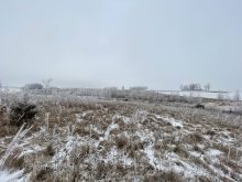
A strong area of low pressure over the Thanksgiving weekend brought heavy rains and snow to parts of Saskatchewan and north-central Manitoba. It’s now looking like we’ll see another area of low pressure follow a similar path to start this forecast period.
The weather models are showing an area of low pressure building across the American southwest and then lifting northeastwards into southern Saskatchewan and Manitoba starting Thursday. Currently the track of the low will bring the most significant rainfall to eastern Saskatchewan and western Manitoba with latest model runs showing totals in the 20 to 30 mm range.
The low will take until Saturday to finally push off east. As colder air get pulled southwards on Saturday. A few wet flurries could be possible over central and southern Manitoba. Cold air looks to stay in place right through the weekend with daytime highs in the low single digits and overnight lows falling to around -4 C.
An area of low pressure developing over Alberta will drop southeastwards early next week. While this low will not directly impact Saskatchewan or Manitoba, mild air will push back in starting on Monday with daytime highs moving back into the low teens. The mild conditions look to last at least to the end of next week as our current active pattern looks to quiet down a little bit.