We saw an end to hot conditions over the last week, and the weather models did a fairly good job with the forecast. There were a couple of misses. First off, the cold front brought slightly cooler temperatures than was forecasted. Second, the low that impacted southern Alberta brought much stronger thunderstorms than originally forecasted. The same low didn’t head eastwards a quickly as forecasted.
For this forecast period, it’s looking like the forecasted strong area of high pressure is going to dominate the weather across the Prairies. This should bring plenty of sunshine and warming temperatures. Overnight lows look to be seasonable, so at this point it doesn’t look like we’ll see heat warnings—but as usual you just never know.
Read Also
Prairie forecast: Arctic air dominates the forecast
For this forecast period, it appears we will need to wait a little longer for spring to arrive. Weather models continue to show a northwesterly flow across the region, but this time the dividing line between mild and cold air has shifted slightly farther south. As a result, near to below-average temperatures are expected across much of the Prairies.
The high pressure is forecasted to drop southwards into northern Saskatchewan on Wednesday and continue slowly dropping southwards and strengthening as the week progresses. By Friday, the center of the high is expected to be over southern Saskatchewan with a ridge of high-pressure stretching northwards into the territories. This surface high and ridge will continue to drop southeastwards over the weekend into next week.
With high pressure firmly in place, the only chances for precipitation will be over Manitoba on Wednesday and Thursday as the Prairie low departs, and then over Alberta later in the forecast period with widely scattered thundershowers or storms.
Alberta
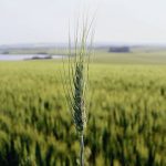
Much of Alberta will see sunny to partly cloudy skies as a ridge of high pressure builds southeastwards out of the Territories. This high will bring warm temperatures to the northern half of the province. Temperatures are forecasted to be in the mid twenties on most days. Southern regions will not feel as strong as an influence from the high, which will make for slightly cooler temperatures.
The weather models are not showing any strong areas of low pressure impacting the province during this period. A southeasterly flow is forecasted to develop, which will bring some moisture into the southern half of the province starting over the weekend. The southeasterly winds and moisture will combine to trigger scattered afternoon thundershowers. The odd thunderstorm cannot be ruled out. Coverage and amount look light, but there’s always the possibility of a few localized heavier rain events. This pattern looks to continue into the first half of next week.
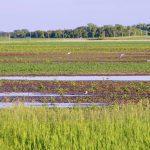
Saskatchewan and Manitoba
Saskatchewan will see one last day of cloudy or partly cloudy skies before an area of low pressure moves off east. This low will bring those same cloudy to partly cloudy skies to Manitoba on Wednesday and Thursday before that it tracks off into northwestern Ontario. Along with the clouds there will be the occasional shower or thundershower, but not much in the way of accumulations are expected. For those areas that see thundershowers, a quick 10-20 mm can not be ruled out.
By Friday, high pressure building southwards will bring sunny skies, light winds and seasonable temperatures. Expected daytime highs to be on the low twenties on Friday, warming into the mid twenties over the weekend. Overnight lows will also be seasonable and make for some nice sleeping weather. Expect lows to start off around 10 C warming towards 14 C by Sunday.
Sunny skies and seasonable temperatures are forecasted to last until at least Tuesday. At this point, the weather models are showing an area of low pressure developing over Montana and then lifting northeastwards. This brings a good chance of showers and thundershowers to Saskatchewan on Tuesday and Manitoba on Wednesday. Confidence in this system is low at this point.
— Daniel Bezte is a teacher by profession with a B.A. (Hon.) in geography, specializing in climatology from the University of Winnipeg. He operates a computerized weather station near Birds Hill Park, Man. Contact him via email with your questions and comments.