The weather models did a good job with the big picture in the last forecast but missed out on some of the finer details. The eastern low took a little longer to move out than expected, and temperatures warmed up more than originally forecasted.
This forecast period is looking straightforward as surface high pressure and upper-level ridging looks to dominate the forecast. This should bring what looks to be an extended period of sunny skies and warm to hot temperatures.
On Wednesday morning, there’s a strong upper-level ridge centered over B.C. with a large surface high over northern Manitoba. This surface high is forecasted to drop southeastwards towards the Great Lakes over the next few days. This will place the Prairies in a generally warm southerly flow.
Read Also
Prairie forecast: Arctic air keeps spring warming at bay
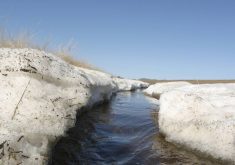
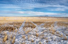
This week’s forecast: Arctic high pressure is expected to drop southward into the Prairies later this week and into the weekend, keeping temperatures below average.
Meanwhile, an area of low pressure over Alaska is forecasted to track across far northern Canada from Wednesday to Sunday. This will help to allow the upper ridge over B.C. to broaden and expand eastwards to cover most of the Prairies by this weekend.
Early next week, as the upper ridge begins to collapse, the weather models show low pressure developing over northern Saskatchewan and the dropping southeastwards into central Manitoba. Confidence in the system is low, but should it develop, it would bring partly to mostly cloudy skies on Tuesday and Wednesday and the chance of some showers or thundershowers.
Alberta
It’s a short and hot forecast as we head into the last few days of August and the start of September. Upper-level ridging, which has brough record breaking temperatures to B.C. earlier this week, will bring plenty of sunshine and hot temperatures to the whole province until at least Saturday or Sunday. Expect daytime highs to be in the low to mid thirties with overnight lows falling to around 12 C. Warmest temperatures are forecasted to be found across central and northern regions.
Over the long weekend, the upper ridge will begin to collapse. This will bring slightly cooler air into the region. On Monday, the weather models are showing an area of low pressure developing over northern Saskatchewan. This low will pull cooler air southwards across the province along with a few clouds and maybe the odd shower or thundershower. Temperatures to start the first week of September look to be seasonable with daytime highs forecasted to be in the low twenties.
Saskatchewan and Manitoba
Much like Alberta, the forecast looks to be short and hot as we head towards the long weekend. Upper-level ridging building eastwards will bring very warm temperatures to Saskatchewan on Wednesday with these hot temperatures looking to last right through until Monday. Expect daytime highs to be in the low thirties with over night lows falling to a comfortable 12 to 14 C.
Across Manitoba, a surface high is forecasted to drop towards the Great Lakes from northern Manitoba. This surface high is a little on the cool side which will result in a bit of an east-west temperature gradient over the next couple of days. Far eastern regions will see daytime highs in the low to mid twenties, while western regions will see highs in the upper twenties to low thirties. As the high continues to push eastwards, by Friday all regions will be under the influence of the upper ridge with daytime highs across all regions forecasted to be in the upper twenties to low thirties. Sunny and hot conditions look to last right though the long weekend.
On Monday, an area of low pressure is forecasted to develop over northern Saskatchewan as the upper-level ridge begins to collapse. This low will track towards central Manitoba on Tuesday. As the low passes by, most regions can expect a mix of sun and clouds and cooler temperatures. Expect dytime highs falling into the low twenties. Best chance of seeing any precipitation from this system will be across central Manitoba on Tuesday. As usual, confidence in this system is low this far out. Confidence in the upper ridge breaking down and more seasonal temperatures moving in is fairly high.