The forecast from the Canadian Wheat Board: up to 50 per cent greater accuracy from the online weather information system it offers to Prairie farmers.
A new modelling system in place on WeatherFarm is expected to reduce error in short-term forecasts (that is, up to 12 hours) by up to 50 per cent, the CWB said in a release.
The modelling system has been used by the U.S. National Weather Service and the U.S. military, with “nudging” techniques that fine-tune computer forecasts against actual surface weather conditions to adjust predictions for better accuracy, the CWB said.
Read Also

Rodeo hall of fame inductee blowing out candles on celebrated cowboy life
Canadian Pro Rodeo Hall of Fame inductee’s family reflects on a fun and interesting southern Alberta life on and off the cowboy grounds.
The enhanced forecasts, the CWB are made possible by the density of the WeatherFarm network, set up in 2007 by the board working with Weather- Bug, an online global forecasting system.
Also added to WeatherFarm is radar imaging, used to generate bird’s-eye map views of weather systems that can move and zoom to within one kilo-metre above a particular farm, allowing producers to pinpoint immediate weather threats.
The map views can also distinguish between rain, freezing rain and snow, the board said.
“The radar imagery shows the exact locations, amounts and types of precipitation that are falling,” CWB weather network manager Guy Ash said in the board’s release. “When producers zoom in, they can see exactly how close it is to their farm.”
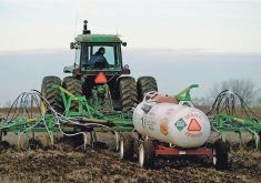
The WeatherFarm network, which includes 800 monitoring stations across the Prairies, is now considered the largest private weather network in Canada. WeatherFarm’s forecasts, using data from those stations, predict hourly conditions for temperature, wind, relative humidity, a heat and wind-chill index, dew point, sky cover and chance of precipitation. A set
Frequent forcasts
New models of forecasts for each local station is generated every six hours.
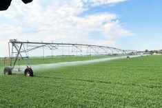
Farmer users can view WeatherFarm’s agricultural maps and models to help manage emergence of pests such as fusarium head blight and wheat midge, monitor crop growth stages and assess frost severity. An “enhanced” set of models for various crops comes out this spring, the CWB said.
The online WeatherFarm centre has also now added full-colour “visual gradient” temperature and precipitation maps, updated every 10 minutes, showing weather systems as they move across Canada and the world. A scroll-down window allows users to choose from 10 different weather parameters for their maps.
Maryland-based tech firm Earth Networks, which operates WeatherBug using data from over 8,000 weather stations worldwide, is now working to expand the Weather- Farm network across the entire country, the board said.
———
“Whenproducerszoomin,theycanseeexactlyhowcloseitistotheirfarm.”
GUY ASH
CWB