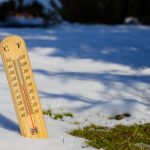
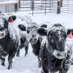
The cold weather has also been replaced by above average temperatures. The question I have been hearing the most is--has spring arrived or is there still a bit of winter left to be felt?

Prairie forecast: Very warm west, mild but a little unsettled east
Issued March 13, covering March 13 to 20

Below-normal spring runoff for most of Saskatchewan
Most of Saskatchewan will experience below-normal to well below-normal levels of runoff in 2024, according to the provincial Water Security Agency's Spring Runoff Forecast for 2024, released March 12.

Precipitation does little for Prairie drought relief
Most areas dryer than a year ago, drought monitor shows
While much of the Prairies received above-normal amounts of precipitation during the month of February, the additional moisture did little to alleviate dry conditions according to Agriculture and Agri-Food Canada’s (AAFC) Canadian Drought Monitor (CDM).

Prairie forecast: Stormy start in the east, warming in the west
Issued March 6, covering March 6 to 13, 2024
After what was probably the biggest storm system of the winter, it looks like this forecast period will see a break from the active weather for the most part.

Prairie forecast: Storm system heads for southern Prairies
Updates forecast issued Feb. 29, covering Feb. 29 to March 6, 2024
The weather models have come into fairly good agreement for the storm system forecasted to impact much of the southern prairies over the next 24 to 48 hours. An area of low pressure is developing over Wyoming with an inverted trough stretching northwestwards.

Volcanic eruptions and climate
Contents of volcanic ejections and location of volcano can change impact
Reading Time: 3 minutes Several weeks ago, I received a question about the Tonga volcanic eruption that occurred Jan. 15, 2022. I was asked what impact that eruption may have had on our climate and whether it contributed to record-breaking global temperatures last year. One headline in particular stood out for me regarding those high temperatures, but probably not […] Read more

Warm spring in the forecast for most of Canada
Moisture predicted to be normal across most of the country
All of Canada, aside from Yukon and parts of the Northwest Territories are expected to see warmer than normal temperatures over the next three months, according to the latest long-range seasonal forecast from Environment and Climate Change Canada, released Feb. 28.

Fading El Niño to be replaced by La Niña: The Weather Network
Warmer than normal temperatures expected to continue on the Prairies
Fading El Niño weather patterns will be replaced by La Niña conditions heading into the summer, according to the latest seasonal forecast from The Weather Network.

Prairie forecast: More much-needed moisture expected
Issued Feb. 29, covering Feb. 29 to March 6, 2024
Cold Arctic air has invaded the Prairies much to many people’s surprise. We have gotten so used to mild spring-like weather that some people may be put off that winter has returned. For those who read my last column, this type of weather shouldn't be surprising since we are now moving into what can be the snowiest time of the year.

Prairie forecast update: Storms roll in
Updates forecast issued Feb. 21, 2024
The weather models are coming into agreement with up coming storm system. The low was forecasted to develop over southern Alberta on Sunday with widespread snow developing to the north and west of the low. This placed the Edmonton region in the main snow band with 10 or so centimetres forecasted to fall across this region. The snow should move out quickly on Monday as cold arctic air pours southwards behind the low dropping temperatures to below average, but only for a couple of day.

