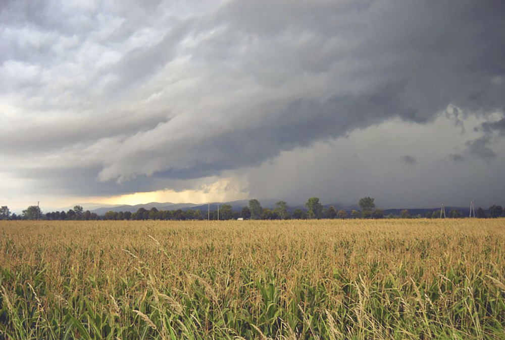
What turns a regular thunderstorm into a severe thunderstorm, or occasionally, into a thunderstorm that you truly remember?
First, there is a hot humid air mass in place, the air a few thousand feet up is very cold, providing for good lift, and there is a strong jet stream overhead to provide venting at the top of the storm.
We are ready for a severe thunderstorm.
Read Also

How Earth evens out the energy input
Earth has surpluses of radiation in its equatorial regions, and deficits toward its poles. Our weather is a matter of Earth trying to even out the imbalance, Daniel Bezte writes.
Over the last week or so, we’ve had plenty of heat and humidity, but we didn’t have really cold air aloft, and we didn’t have a strong jet stream overhead. If we did, everything would be in place for a severe thunderstorm. What can Mother Nature add to the mix to make things worse?
The first and probably most important extra ingredient is a change in wind direction with altitude. Air can flow horizontally, but this horizontal direction can change with altitude. Why would this have an impact on a storm?
This change of direction can cause the developing storm to rotate. Picture what would happen to a rising parcel of air if pushed on from the south when it was at the surface. Then, as it rises a couple thousand feet, the wind switched direction and blew from the east. Then a few thousand feet further up, it blew from the northwest.
What would happen to our rising parcel of air? It would get twisted and it would start to rotate.
If air rotates counter-clockwise, it will create an area of low pressure. Air spirals inwards, in a counter-clockwise rotation. This means the air will converge near the centre of this rotation. This converging air can move either downward or upward. Since the ground prevents air from moving downward, and the air already wants to move upward, it often does so very fast.
The second thing a rotating thunderstorm can do is separate the area of updrafts and downdrafts. This is important, since the downdrafts, even with a severe thunderstorm, will eventually cut the updraft from its source of warm moist air.
READ MORE: Alberta leads country in dreaded hail
In a rotating thunderstorm, the source of warm, moist air is maintained, giving these storms a long life and a lot of moisture to produce heavy rains.
A rotating column of air can provide conditions for tornadoes to form. While we do not fully understand how, we do know that rotating thunderstorms can and often do produce tornadoes.
It is believed that rotating columns of air get squeezed into a narrower shape. As this happens, wind speeds increase, eventually producing the tornado. It’s the theory of the conservation of angular momentum. The classic example is the spinning figure skater who pulls in their arms to increase the rate of rotation.
Like most things in nature, thunderstorms rarely behave like textbook examples. Even when all the ingredients are there, no storms may form, or sometimes a key ingredient is missing yet we get a really severe storm. This is what makes weather so interesting.
Not every thunderstorm becomes severe, of course. In fact, much of our summer rainfall comes from garden-variety thunderstorms, or what are called air mass thunderstorms.
These storms develop in the middle of a typical warm summer air mass. Because they are in the middle, a number of key ingredients for severe storms are missing. This is what we saw during the heat wave.
The area of low pressure to our south during the heat wave created areas of instability and convergence that helped kick off thunderstorms, but there was no cold air aloft, a key ingredient for severity.
Usually, in the middle of an air mass, temperature will not decrease rapidly with height. The wind will usually remain constant, and there will probably not be a jet stream overhead.
Nonetheless, we can still have enough heat and humidity for air to rise and thunderstorms to form. Since these storms don’t rotate or have any way to vent, they rarely last long. Accumulating air at the top of the storm will eventually fall as a downdraft, wiping out the updraft and essentially killing the storm.
While these storms are short-lived, they can give brief periods of heavy rain and the odd, good gust of wind, especially when the downdraft first hits the ground. These storms often provide us with just the right amount of precipitation when needed during the summer.