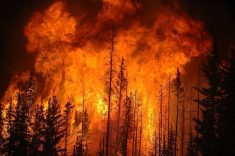
Though we are near the end of summer and the peak of thunderstorm season, there are still opportunities for severe weather.
Let’s look at the most destructive yet awesome weather event associated with thunderstorms: tornadoes.
Worldwide, Canada is second only to the United States in the number of tornadoes occurring each year, with an average of about 70 reported. Southern Ontario experiences the highest number, followed by southern Manitoba, Saskatchewan and central Alberta.
While these areas report most of Canada’s tornadoes, they have occurred in nearly all regions of Canada.
Read Also

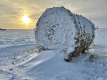
Winterkill threat minimal for Northern Hemisphere crops
The recent cold snap in North America has raised the possibility of winterkill damage in the U.S. Hard Red Winter and Soft Red Winter growing regions.
So, the big question is: how do tornadoes form? As good as our technology is, we are still not 100 per cent sure how tornadoes form, but there are several theories:
- supercell theory;
- rear-flank downdraft theory;
- tornado vortex theory; and
- multiple vortex theory.
The first two theories are tied together as they both involve supercell thunderstorms. To understand these two, we need to understand what a supercell thunderstorm is.
Thunderstorms are fuelled by warm, moist air near the surface and colder air aloft. What makes a supercell thunderstorm different from a regular thunderstorm is the ability to sustain a rotating updraft.
These storms can rotate due to wind shear or the change in wind speed and direction with height. As a supercell thunderstorm evolves and the updraft intensifies, it draws in warm, moist air, which helps drive further storm development.
With the right type of wind shear, the updraft becomes tilted. That does two things. It helps keep the updraft separate from the downdraft, allowing the storm to continue growing, and the tilt stretches and squeezes the rotating column of air vertically, making the rotating air spin faster.
This is what scientist believe leads to development of tornadoes, but the exact mechanism is not fully understood. This leads to the second theory, rear-flank downdraft.
As the supercell thunderstorm evolves, a region of cool, descending air develops on the backside of the storm. This is the downdraft that all storms have, but due to the wind shear that tilts the storm, this downdraft does not come crashing down from the main updraft area. Instead, it interacts with the updraft by enhancing the low-level inflow and rotation, which in turn can be pulled into the updraft.
The third theory, the tornado vortex theory, is similar to the supercell theory. It states that tornadoes form when horizontal spinning air in the storm updraft is tilted vertically by a strong updraft. These rising columns of air can move very fast, and as they rise, it stretches and tightens or contracts the rotating column of air, much like a figure skater pulling in their arms when spinning. This causes an increase in spin rate.
The process is known as vortex stretching and the intensified spinning motion within the storm may lead to formation of a tornado.
The last theory is multiple vortex theory. As the name suggests, the main vortex within a thunderstorm contains multiple smaller vortices rotating within the main circulation. These smaller vortices can appear as satellite tornadoes or as sub-vortices within the primary tornado. This phenomenon results in a tornado with a more intricate appearance, often displaying a spiral pattern of swirling winds within the main funnel.
According to the multiple vortex theory, the main column of rising, rotating air serves as the parent vortex and provides the circulation or rotation necessary for tornado formation. As the parent vortex intensifies, it can spawn smaller satellite vortices. These satellites typically rotate around the main funnel cloud and this is often why we see unique and intricate structures in tornadoes.
The interactions between these satellite vortices can create a complex pattern as the individual vortices merge, split and interact. This can result in the rapid change in shape, size and intensity of the tornado. This chaotic behavior can help explain the erratic movement and characteristics we sometimes see in tornadoes.
How these satellite vortexes are formed is still not known. The constantly changing environment within the storm, and the physical landscape over which it travels, can cause these satellite vortices to spin up, grow larger and then simply die away.
I think all theories bring something to the table and as with most complex systems, it is probably a combination that leads to formations of tornadoes.
The one thing the theories have in common is the need for a strong, well-established thunderstorm that either has rotation or is in an environment where columns of air can gain rotation.
Hopefully, as technology gets better, research will lead to the definitive answer on the formation of tornadoes, and that in turn leads to better warnings.