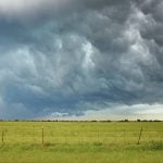
Reading Time: 2 minutes The numbers are still coming in for the cost of the damage caused by a huge hail storm that hit various areas of Alberta Aug. 20.

Massive storm in southeastern Alberta causes significant damage to crops and reported deaths of livestock
Several farmers report harrowing experience of being caught in massive hail storm in area around Brooks

Prairie forecast: Warm and dry for the long weekend
Forecast issued August 27, covering Aug. 27 to Sept. 3, 2025
This forecast period is looking straightforward as surface high pressure and upper-level ridging looks to dominate the forecast. This should bring what looks to be an extended period of sunny skies and warm to hot temperatures.

Heatwaves and upper highs
Sunshine and sinking air mean rising temperatures
Reading Time: 4 minutes Weather expert Daniel Bezte looks at heat waves and the climate factors that lead to extended periods of high heat in the Prairies.

Prairie forecast: Sunny, warm end to the month
Forecast issued August 20, covering Aug. 20 to 27, 2025
To start this forecast period, we have an area of low pressure developing over Montana. This will help bring one more day of intense heat over southern Saskatchewan and a hot day over Manitoba. That same low will bring partly cloudy skies and the chance of showers to a good portion of Alberta.

Prairie forecast: Unsettled weather to continue
Forecast prepared August 13, covering August 13 to 20, 2025
For this forecast period it looks like the active pattern that developed last week will continue with a couple of lows forecasted to impact parts of the Prairies.

Low yield allowance adjusted to support farmers in Alberta
Provincial, federal governments help Alberta farmers turn low-yield crops into feed
Reading Time: 2 minutes Alberta farmers can move more quickly to salvage poor crops for feed, after the federal and provincial governments announced increases to AFSC's low yield allowances for the 2025 crop year.

Prairie forecast: Merging lows bring plenty of chances for rain
Forecast issued Aug. 6, covering Aug. 6 to 13, 2025
For this forecast period we start with a small but fairly potent area of low pressure lifting northwards through Manitoba. Meanwhile, weak high pressure is covering Alberta and Saskatchewan.

Prairie forecast: Sunny and warm with a chance of rain
Forecast issued July 30, covering July 30 to August 6, 2025
This forecast period is looking much more stable and predictable as a large area of high pressure dominates the Prairie region.

Several Alberta municipalities declare a state of agricultural disaster due to dry conditions
Summer drought is making a major impact on Alberta farmers
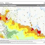
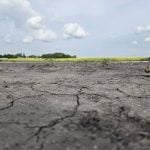
Reading Time: 5 minutes Numerous municipalities in Alberta have declared a state of agricultural disaster due to drought conditions which have wreaked havoc on farmers across the province.

Prairie forecast: Near-average temperatures as messy weather pattern continues
Our current unsettled and—for lack of better word—'messy' weather pattern looks to continue for at least one more week.
